
How to get from Stanley Park to Vancouver Pacific Central Station
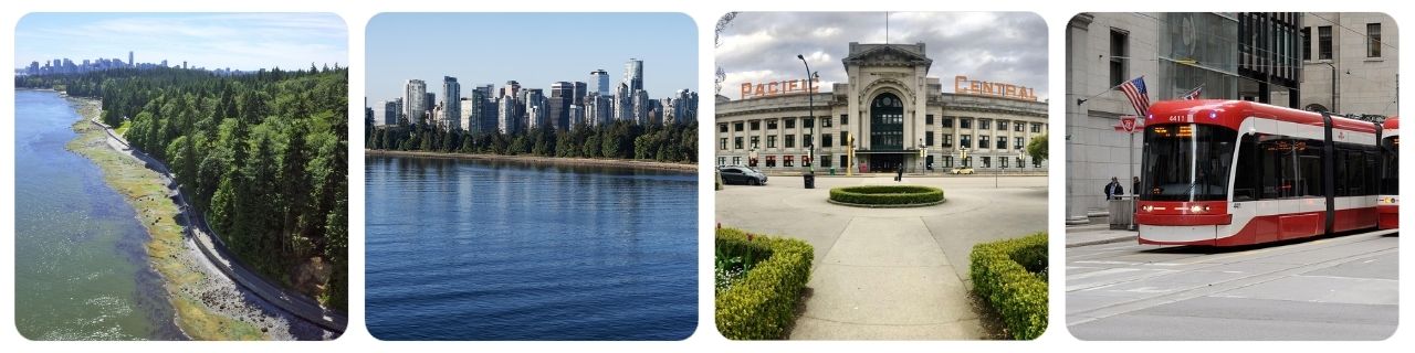
Stanley Park sits on Vancouver’s northwest edge, while Vancouver Pacific Central Station (1150 Station St) is on the east side of downtown—so your best route depends on time, luggage, and where you are inside the park.
At A Glance (Stanley Park to Vancouver Pacific Central Station)
| Mode | Duration | Best For |
|---|---|---|
| 🚌🚆 Public Transit (Bus + SkyTrain) | ~30–55 min (transfer-dependent) | Budget travelers, predictable costs |
| 🏷️ Cost: typically ~CAD 3–6 one-way depending on fare type/zones | » plan with TransLink | fare zones | ||
| 🚕 Taxi / Ride-hailing | ~15–30 min (traffic-dependent) | Door-to-door, heavy luggage, groups |
| 🏷️ Cost: typically ~CAD 20–45+ depending on traffic/surge | » prebook a driver | compare transfer offers | ||
| 🚲 Bike (Mobi / rental) | ~35–70 min (route & pace) | Daytime, light luggage, good weather |
| 🏷️ Cost: from a few dollars (bike share/rental-dependent) | » find a Mobi station | compare bike rentals | ||
| 🚗 Car / Rental Car | ~15–30 min (+ parking time) | Multiple stops, late-night flexibility |
| 🏷️ Cost: fuel + parking; rentals vary | » compare car rentals | ||
Which Option or Route Should You Choose?
- Fastest/Most Convenient: Choose Option #2 — Taxi / ride-hailing if you’re on a tight schedule or have bulky bags.
- Cheapest/Most Economical: Choose Option #1 — Public transit for the lowest typical cost with reliable citywide coverage.
- Most Scenic/Flexible (daytime): Choose Option #3 — Bike for a beautiful ride out of Stanley Park and across downtown.
- Best if you’re already driving: Choose Option #4 — Car / rental if you need to do errands or continue beyond the station.
How to Book and Practical Tips
- Start by pinning your exact spot: Stanley Park is huge. Your walking time to the nearest stop (or bike dock) can add 10–25 minutes.
- Transit fares & tickets: If you’re using public transit, check pricing and fare zones and consider a Compass Card for easy tap-and-go.
- Leave buffer time before a train/bus departure: Pacific Central handles intercity buses plus VIA Rail/Amtrak—arrive early if you need to print tickets or check baggage.
- Ride-hailing in Vancouver: Uber and Lyft operate in Vancouver—great backups if you can’t get a taxi quickly.
- Luggage strategy: If you want to explore before departure, consider luggage storage near the station via luggage storage in Vancouver Pacific Central Station.
- Weather matters: Rain is common—bike only if you’re comfortable riding on wet paths (or switch to public transit).

🚌🚆 Option #1 — Public Transit (Best Value, Predictable Cost)
Low cost Frequent service Transfers possible
- Overview: Take a bus out of Stanley Park toward downtown, then connect to SkyTrain (or a direct bus) to reach the Main Street–Science World area, which is a short walk to Pacific Central Station.
- Typical time: ~30–55 minutes total, depending on where you start inside the park and whether you hit a quick connection.
- How to plan (with price): Use the Trip Planner and check pricing and fare zones. Most trips within Vancouver are typically priced like a 1-zone ride (fare type/time-of-day dependent).
- Helpful route reference: If you’re near the loop, Route 19 Metrotown Station/Stanley Park is one of the key lines serving the area.
- Pros: Cheapest, no parking stress. Cons: Less comfortable with large luggage; can involve walking and transfers.
Step-by-step: Public Transit
- Get to a transit stop: If you’re deep in Stanley Park, walk or shuttle within the park to the closest major stop area (many visitors aim for Stanley Park Loop or stops along West Georgia/Denman depending on location).
- Ride a bus toward downtown: Board the best bus for your exact location and time using the Trip Planner.
- Connect toward Main Street–Science World: Depending on your itinerary, either stay on buses that run east/southeast or transfer to SkyTrain to reach Main Street–Science World.
- Walk the final stretch: From the station area, follow signs or map directions to Pacific Central Station (it’s close, but expect a few minutes on foot).
- Buying/using fares: If you’ll ride more than once, consider a Compass Card for quick tap-in/tap-out and easy reloading.
Getting to the main boarding points (Stanley Park Loop / nearby downtown stops)
- Stanley Park Loop: A convenient bus terminal area if you’re near the park’s southeast edge (near the entrance by West Georgia).
- Denman Street / West Georgia corridor: If you’re near English Bay/Lost Lagoon side, it can be faster to walk to downtown-facing stops outside the park rather than backtracking inside.
- When in doubt: Put your exact landmark into the Trip Planner (for example “Prospect Point” or “Totem Poles”) to minimize unnecessary walking.
- Locations/Trip Planner: 🔗 Google Map / 🔗 OpenStreetMap
🚕 Option #2 — Taxi / Ride-hailing (Fastest Door-to-Door)
Door-to-door Best with luggage Traffic & surge
- Overview: Request a ride from your exact spot (or nearest pickup point) in/near Stanley Park directly to Pacific Central Station.
- Typical time: ~15–30 minutes, depending on where you are in the park and downtown traffic.
- How to book (with price): For prebooked private transfers, use Welcome Pickups in Vancouver or compare quotes on GetTransfer in Vancouver. For app-based rides, Uber and Lyft are widely used in the city.
- Pros: Easiest with bags; fastest if connections are inconvenient. Cons: Costs fluctuate (traffic/surge); pickup inside the park may require walking to a legal/accessible pickup point.
Step-by-step: Taxi / Ride-hailing
- Choose your pickup point: In Stanley Park, vehicles can’t access every trail/area—walk to a road-accessible spot or a parking area.
- Request or prebook: If you want a fixed plan (especially early morning), book ahead with Welcome Pickups or GetTransfer.
- Set the destination precisely: Use “Pacific Central Station, 1150 Station St” to avoid being dropped at a nearby bus bay or the wrong entrance.
- Build in station time: If you’re taking rail, give yourself extra minutes for platforms, ticketing, or baggage rules at Pacific Central.
Getting to the main pickup points (road-accessible spots in/near Stanley Park)
- Park entrances & parking lots: If you’re at the Totem Poles, Tea House, or Prospect Point, you can usually arrange pickup at nearby road pull-ins or parking lots.
- Downtown edge: If the app can’t find you inside the park, walk to the nearest major intersection on the downtown side (Denman/Georgia area) and request from there.
- Alternative apps: Uber and Lyft operate in Vancouver (availability can vary by time and demand).
- Locations/Trip Planner: 🔗 Google Map / 🔗 OpenStreetMap
🚲 Option #3 — Bike (Scenic, Often Quick in Daytime)
Scenic route Avoids traffic Weather-dependent
- Overview: Bike from Stanley Park to downtown and across to the station area using protected bike lanes where possible. This is a great option if you have light luggage and daylight.
- Typical time: ~35–70 minutes depending on pace, stops, and your exact starting point within the park.
- How to book (with price): For bike share, check the live dock map on Find bikes and stations. For classic day rentals (especially if you want a helmet/basket), compare options on bike rental in Vancouver.
- Pros: Beautiful ride; often faster than buses in daytime congestion. Cons: Not ideal in heavy rain; awkward with rolling suitcases; watch for pedestrians on shared paths.
Step-by-step: Bike
- Pick your bike: If using Mobi, open Find bikes and stations and head to the closest dock with available bikes.
- Leave Stanley Park safely: Aim for the park’s bike routes and exit toward downtown (the most common flow is toward the West Georgia / Coal Harbour side).
- Cross downtown on protected lanes: Use a route that keeps you on calmer, marked bike infrastructure where possible.
- Arrive near the station: Dock/lock your bike near Pacific Central Station and walk in with your essentials.
- If you need to store bags: Consider luggage storage in Vancouver Pacific Central Station so you can ride without carrying everything.
Getting to the main bike starting points (Mobi docks / rental shops)
- Mobi docks: Use the live map on Find bikes and stations to see the closest docks around the park’s edges.
- Traditional rentals: If you want a full-day rental (often with better comfort and accessories), compare providers on bike rental in Vancouver.
- Locations/Trip Planner: 🔗 Google Map / 🔗 OpenStreetMap
🚗 Option #4 — Car / Rental Car (Flexible, Good for Multi-stop Days)
Flexible Good for groups Parking needed
- Overview: Drive from Stanley Park to Pacific Central Station. This can be fast, but parking around the station can add time and cost.
- Typical time: ~15–30 minutes driving, plus time to find parking and walk to the station entrance.
- How to book (with price): If you need a rental for the day, compare providers on cheap car rental in Vancouver.
- Pros: Best for multiple stops, late-night flexibility, and splitting costs among a group. Cons: Parking downtown can be expensive; traffic can be slow at peak hours.
Step-by-step: Car / Rental Car
- Decide if you’ll drop off or park: If you’re continuing by train/bus, consider passenger drop-off first, then parking/returning the vehicle.
- Drive out of Stanley Park: Follow the park’s signed exits toward downtown streets; expect slower speeds and pedestrian crossings.
- Navigate to the station address: Use “Pacific Central Station, 1150 Station St” for accurate routing.
- Allow time for parking: Plan a buffer for locating a spot and walking in.
Getting to the main starting points (park exits & rental pickup)
- Leaving Stanley Park: The most common exit flow is toward West Georgia; from there you’ll cross downtown to the station area.
- Need a car: If you don’t have one, compare options on cheap car rental in Vancouver and choose a pickup point that’s easy to reach from the park.
- Locations/Trip Planner: 🔗 Google Map / 🔗 OpenStreetMap
FAQ (Stanley Park to Vancouver Pacific Central Station)
What’s the easiest way to get from Stanley Park to Vancouver Pacific Central Station?
If you have luggage or you’re short on time, Taxi / ride-hailing is simplest door-to-door. If you want the best value, public transit is usually straightforward with one connection.
How long does each option take?
Typical ranges: Taxi / ride-hailing ~15–30 min; public transit ~30–55 min; bike ~35–70 min; car ~15–30 min plus parking.
Which transit fare should I expect to pay?
Within Vancouver, most visitors can budget roughly a 1-zone-style fare for bus/SkyTrain travel, but the exact amount depends on fare type and time/day—confirm on pricing and fare zones and consider a Compass Card for easy payment.
Where exactly is Pacific Central Station?
Pacific Central Station is at 1150 Station St, Vancouver. It’s the main intercity rail/bus terminal for VIA Rail and Amtrak Cascades, with nearby SkyTrain access.
Can I store my luggage near the station if I arrive early?
Yes—if you want to explore before departure, you can use third-party storage like luggage storage in Vancouver Pacific Central Station (availability and hours vary by partner location).
Is biking a good idea with a suitcase?
Not usually. If you have rolling luggage, you’ll likely prefer public transit or a car/taxi. Bike works best with a small backpack or a single compact bag.
What if it’s raining hard?
Switch to public transit or ride-hailing. Wet paths and lower visibility make cycling less comfortable.
Related Tours/Services
Popular Routes
Recent Routes
- How to get from London Stansted Airport to Covent Garden
- How to get from Santiago International Airport (SCL) to Valparaíso Cruise Terminal
- How to get from Venice Marco Polo Airport to St Mark’s Square
- How to get from Milan Malpensa Airport to Duomo di Milano
- How to get from Rome Ciampino Airport to Colosseum
- How to get from Casablanca Mohammed V Airport to Medina of Casablanca
- How to get from Stanley Park to Vancouver Pacific Central Station
- How to get from Golden Gate Bridge to San Francisco 4th & King Station
- How to get from Lagos Murtala Muhammed Airport to Lekki Conservation Centre
- How to get from Alhambra (Granada) to Granada Railway Station
Top Travel Gears
FYY Travel Cable Organizer Pouch Electronic Accessories Carry Case Portable Waterproof Double Layers All-in-One Storage Bag for Cord, Charger, Phone, Earphone Black

MiiKARE Airplane Travel Essentials Phone Holder, Universal Handsfree Phone Mount for Flying with 360 Degree Rotation, Accessory for Airplane, Travel Must Haves Phone Stand for Desk, Tray Table

LISEN Airplane Travel Essentials for Women Men Phone Holder for Desk Cruise Vacation Essentials 2026 MagSafe Travel Size Accessories Flying Long Flight Airplane Gadgets Men Father Gifts

Travel Utensils with Case, Quatish Portable Silverware Set for Work, Stainless Steel Reusable Travel Cutlery Set, Fork and Spoon Set for Camping, Picnic, Gadgets, Lunch Box for Men, Black
